Yolo County Soil Series
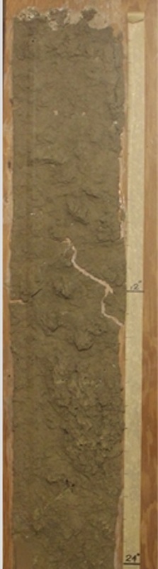
YoloThe Yolo series is a member of the fine-silty, mixed, nonacid, thermic family of Mollic Xerofluvents. Yolo soils have thick grayish brown, neutral silt loam A horizons and brown and pale brown mildly alkaline silt loam C horizons.
|
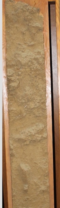
MyersThe Myers series consists of very deep, well drained soils in basins. These soils formed in alluvium derived from mixed sources. Slope ranges from 0 to 10 percent. The mean annual precipitation is about 22 inches, and the mean annual temperature is about 60 degrees F.
|
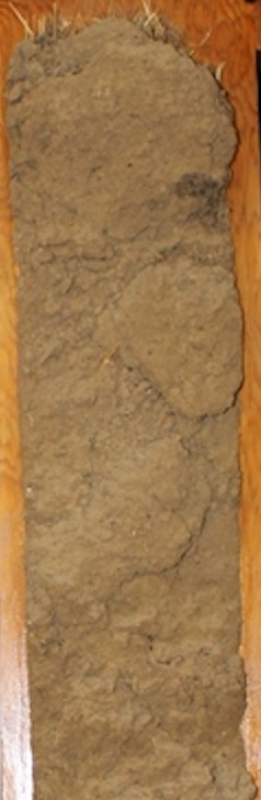
BrentwoodThe Brentwood series have grayish brown, moderately alkaline, clay loam A horizons; brown, moderately alkaline, heavy clay loam B2 horizons; and yellowish brown, moderately alkaline, silty clay loam C horizons that are calcareous.
|
Level 5 Guiding Question: Where can you find information on Soil Profiles?
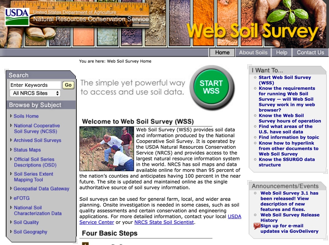
Web Soil Survey (WSS) provides soil data and information produced by the National Cooperative Soil Survey. It is operated by the USDA Natural Resources Conservation Service (NRCS) and provides access to the largest natural resource information system in the world. NRCS has soil maps and data available online for more than 95 percent of the nation’s counties and anticipates having 100 percent in the near future. The site is updated and maintained online as the single authoritative source of soil survey information. Soil surveys can be used for general farm, local, and wider area planning. Onsite investigation is needed in some cases, such as soil quality assessments and certain conservation and engineering applications.
Level 5 Investigation: Define, View, Explore and Checkout
Define
|
|

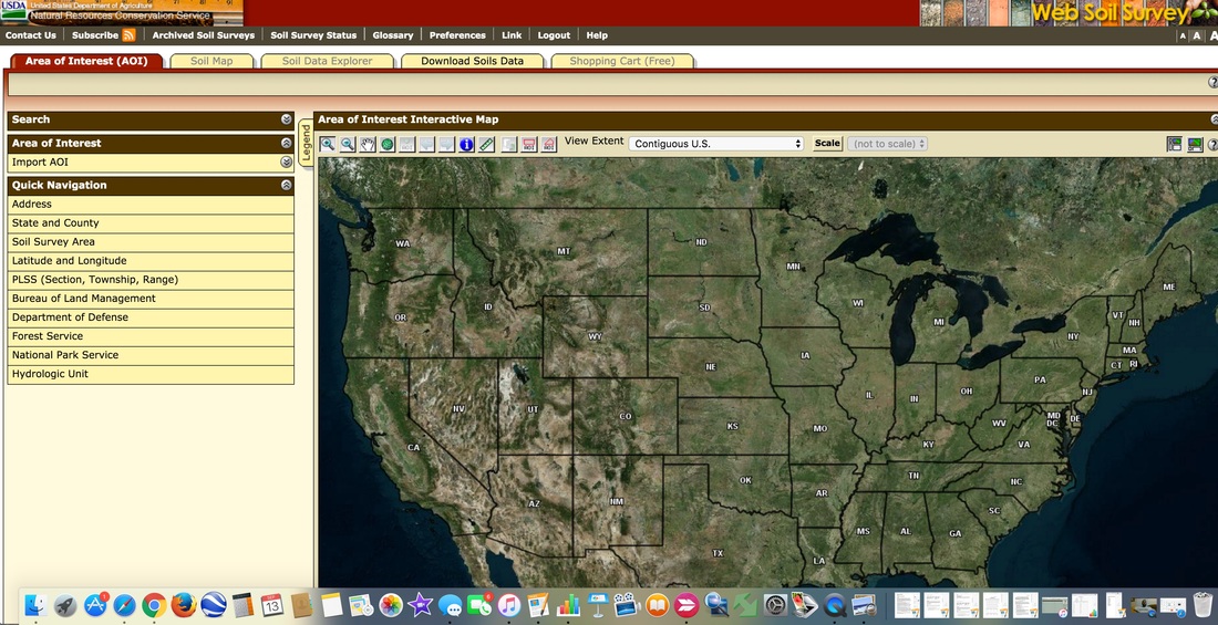
View
|
The next step is to continue defining your view by selecting the area you would like to find out more about. Keep choosing the landscape to investigate until you are satisfied with the proper scale.
|
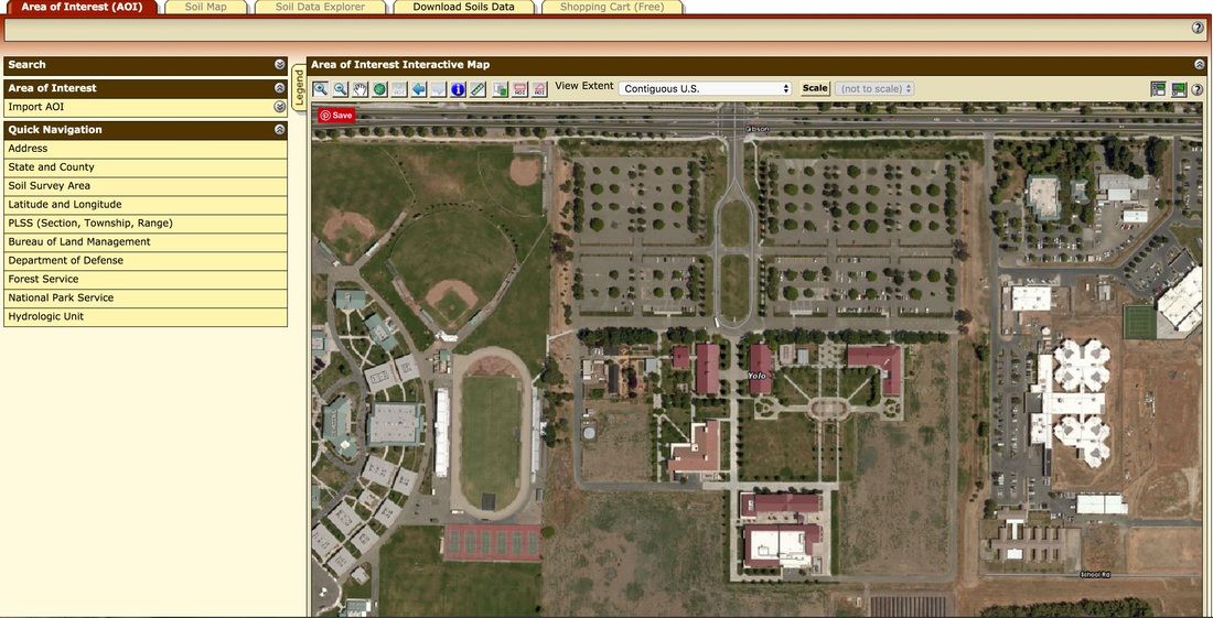
Explore

|
Explore your AOI by clicking the Soil Map tab to access soil data for your area and determine the suitability of the soils for a particular use. The items you want saved in a report can be added to your shopping cart.
|
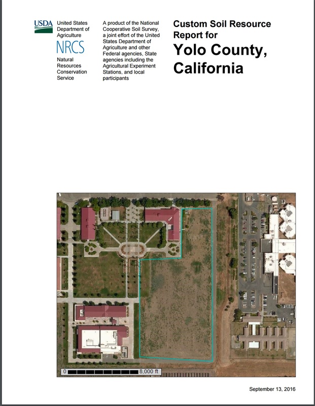
Check out
|
Use the Shopping Cart tab to get your custom printable report immediately, or download it later.
|
Level 5 Videos: View the following videos to learn how to use the NRCS SoilWeb
|
|
|
Level 5 Elaborate: How to create maps and reports
Watch the Video below and complete the attached assignment entitled, "East Woodland Development:.
|
They plan on using the land for homes, elementary, middle and high schools, parks, baseball and soccer fields as well as a shopping complex. Your job is to present them a land use feasibility study the study should include the following:
Soil Series report (drainage, profile description, land capability, erosion rating, Storie index and texture). Your report will have real lab results and maps. As you prepare you will enter your data and questions in the boxes below. You will be evaluated on two areas the data and the presentation to the board of HTD inc. The property is south of Famers Central and Pioneer Avenue and is bordered on the east by Road 102 and goes south for about 4 miles the western border is Pioneer Avenue. |
|
Level 5 Review: Review Soil Series
Click on each soil series button to review the basic characteristics of each soil!
Level 5 Summary: Unit Test
Level 3, 4 & 5 Summary: Unit Test
Click on the image to enlarge
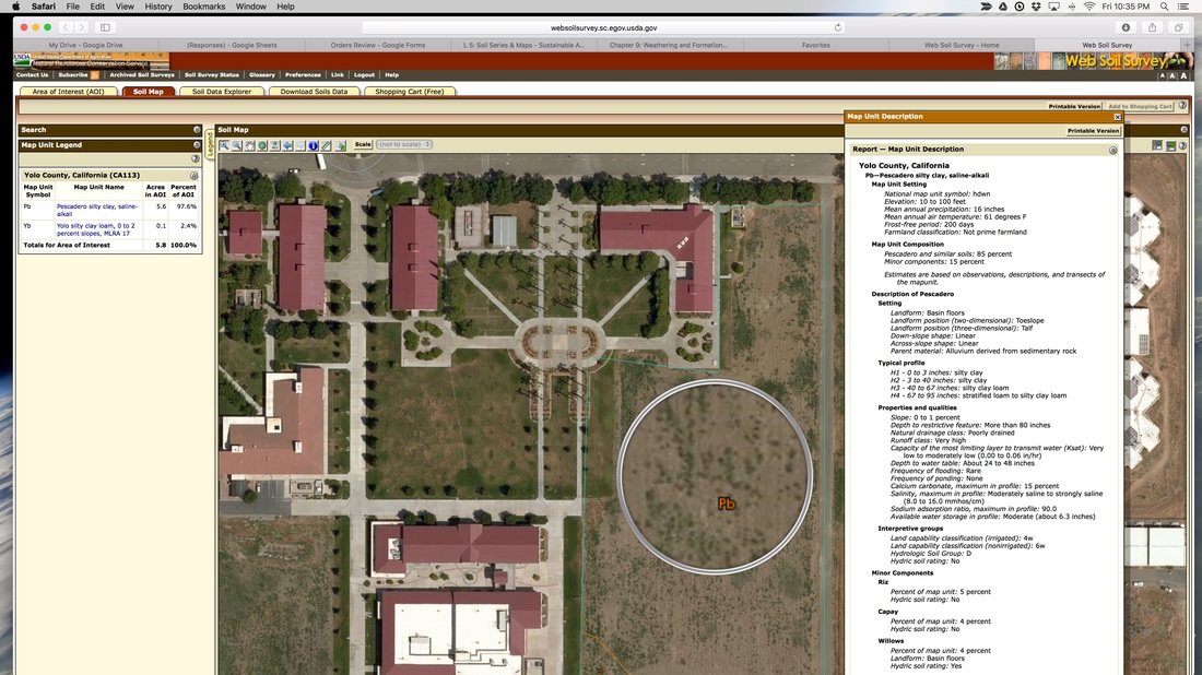
Study the image and read the Map Unit Description then take the test below. If it is hard to read it click the image to enlarge it. I you are still unable to read it please click on the button below it will allow you to download it and print.